Why Does Germany Have Five Exclaves Inside Belgium?
Why does Germany have exclaves inside Belgium? A disused railway, the Vennbahn, left five pockets of German land stranded inside Belgium after World War I.
Key takeaways
- Five pockets of Germany sit inside Belgium because the Vennbahn railway trackbed was handed to Belgium after World War I.
- The five exclaves are Münsterbildchen, Roetgener Wald, Rückschlag, Mützenich, and Ruitzhof.
- Rückschlag, the smallest, covers 1.6 hectares (4 acres) and holds a single house with a garden.
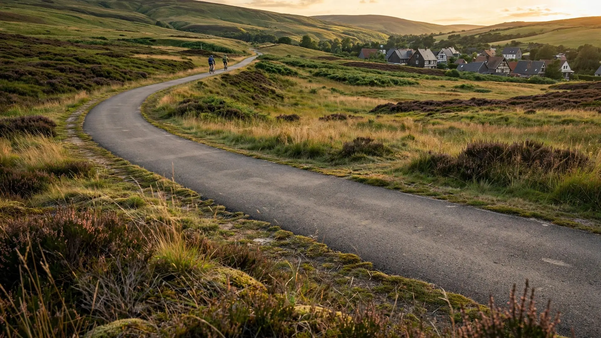
- The disused railway is now a 125 km (78 mile) cycle path running through Germany, Belgium, and Luxembourg.
- A Belgian counter-enclave, a 2,279 sq m traffic island near Fringshaus, existed from 1922 to 1949.
Five pieces of Germany sit inside Belgium, cut off from the rest of the country by a railway that no longer runs. The cause is the Vennbahn, a former coal railway whose trackbed was handed to Belgium after World War I. The narrow Belgian strip follows the old line as it snakes through the hills, and wherever it curves away from Germany, a pocket of German land is left stranded on the Belgian side.
- Construction of the Vennbahn began in 1882 to carry coal from the mines around Aachen to the steel works of Luxembourg and Lorraine. Amusing Planet
- After World War I, the Treaty of Versailles gave the districts of Eupen and Malmedy to Belgium, and a boundary commission awarded the whole railway trackbed to Belgium. Amusing Planet
- Five German exclaves remain today: Münsterbildchen, Roetgener Wald, Rückschlag, Mützenich, and Ruitzhof. Barry's Borderpoints
- The smallest exclave, Rückschlag, covers 1.6 hectares (4 acres) and holds a single house with a garden. Amusing Planet
- The old line is now a 125 km (78 mile) cycle path through Germany, Belgium, and Luxembourg, with an average gradient of 2 percent. East Belgium
What was the Vennbahn, and why did it matter?
The Vennbahn was a railway built across the High Fens, the moorland south of Aachen known in German as the Hohes Venn. Construction started in 1882, when the region was part of Prussia inside the newly unified German Empire. Its purpose was industrial: to move coal from the mines around Aachen south to the iron and steel works of Luxembourg and Lorraine. When the line was complete in 1889, it lay entirely on Prussian soil, running from Aachen through Raeren, Monschau, and Malmedy toward Trois-Ponts, with a branch east to Bütgenbach and Losheim. The line was the economic lifeline of the towns along it. Malmedy and Eupen depended on it for coal, freight, and passengers, and the towns around it grew up around its stations. That dependence became the heart of the border dispute: Belgium argued its new eastern territory would be cut off without the railway, while Germany argued the line had been built by Germans on German soil. The border commission settled the argument in Belgium's favor.
How did a railway line redraw the border?
The Treaty of Versailles, signed in 1919, pushed the German border east and handed the districts of Eupen and Malmedy to Belgium. The new frontier was drawn across the Vennbahn's route, so the line now crossed back and forth between Belgian and German territory. Belgium demanded the whole trackbed, including the stretches that still ran through Germany, and the international commission appointed to fix the exact frontiers agreed. The commission's decision made the track, its embankments, its stations, and its installations Belgian territory. That decision turned a railway into a border. The Belgian strip followed the winding trackbed, a ribbon of land less than 20 meters (66 feet) wide in places, and the German territory west of it was sliced into separate pockets. One of them, Hemmeres, ceased to be an exclave in 1958, leaving the five that exist today. From north to south they are Münsterbildchen, Roetgener Wald, Rückschlag, Mützenich, and Ruitzhof. Life in the exclaves came with strange legal arrangements. Belgium ran five stations inside German territory, serving people who lived in a foreign country. Passengers on the line could pay fares in either German or Belgian currency. Germans who stepped onto railway land for railway business were exempt from customs control, and Belgians who lived on railway land and worked for the railway were exempt from German laws and taxes. The border was drawn, but daily life had to keep working across it. The map even produced a counter-enclave in the other direction. Near Fringshaus, Germany owned the roads that met at a junction inside the Roetgener Wald exclave, and the traffic island where they met, all 2,279 square meters (24,531 square feet) of it, belonged to Belgium. That tiny Belgian island inside German roads lasted from November 6, 1922, until April 23, 1949, when Belgium annexed the roads and the island stopped being an enclave.
| Exclave | Where it sits | What it is like |
|---|---|---|
| Münsterbildchen | Northernmost, near Roetgen | The first exclave on the route from Aachen |
| Roetgener Wald | Forest land south of Roetgen | Woodland crossed by the old line and local roads |
| Rückschlag | Near Monschau | The smallest: 1.6 hectares (4 acres), one house |
| Mützenich | West of the line near Monschau | A village west of the old trackbed |
| Ruitzhof | Southernmost, near Kalterherberg | A small settlement reached by its only access road |
What is daily life like in the exclaves?
The border runs through ordinary streets, and residents live with its quirks every day. In Roetgen, Belgian houses sit directly on the German border where the Mühlenstraße meets the cycle path, and the homeowners reach their front doors by a road that belongs to another country. A German bus stop stands on Belgian soil near Kalterherberg, and the only way into the Ruitzhof exclave is a single access road that turns off the old railway line. Visitors who cycle the route can lose their bearings easily, because the trackbed is Belgian territory while the land on either side is German, and the border markers are small posts at the edge of the path.
The old stations still anchor the villages. Monschau and Konzen kept their station buildings, and Kalterherberg station, with its bridges over the Rur and Schwarzenbach rivers, now offers a rail bike ride along a surviving stretch of track. The exclaves are not museums: people live and work in them, and the railway that created the problem also gave the region its main tourist attraction.
What happened to the railway?
The Vennbahn's fortunes faded with the coal and steel trade it served. Traffic fell through the 1930s, and in 1940 Germany re-annexed Eupen and Malmedy, turning the line back into a wholly German railway for the duration of World War II. After the war the border settlement was restored, and the line kept running into the 2000s. By 2008 it was judged uneconomic, the tracks were lifted, and the route went quiet. The border, however, stayed exactly where the railway had put it. No trains run on the Vennbahn today, yet the five exclaves remain German land inside Belgium. The trackbed itself found a second life. It was paved over as a cycle path that runs 125 km (78 miles) from Aachen-Rothe Erde station through East Belgium to Troisvierges in Luxembourg, crossing three countries in six stages. The route is part of the RAVeL network of slow paths in Wallonia, reserved for non-motorized traffic, and its average gradient of 2 percent makes it an easy family ride. The stages run 22.2 km from Aachen to Raeren, 26.2 km from Raeren to Monschau, 26.7 km from Monschau to Waimes, 17 km from Waimes to Sankt Vith, 14.7 km from Sankt Vith to Burg-Reuland, and 17.6 km from Burg-Reuland to Troisvierges. Along the way riders pass the pottery museum at Raeren, the half-timbered town of Monschau, the moor ponds and meadows of the High Fens, the Our valley, and the tunnels near Lommersweiler and Lengeler. Cyclists cross the German-Belgian border again and again along the way, often without noticing, because the line they are riding is itself Belgian soil while the fields on either side may be German.
What do most people get wrong about the Vennbahn exclaves?
The first mistake is assuming the exclaves are a surveying error. They are the deliberate result of a treaty decision: Belgium was given the railway because it needed the line, and the border was drawn to follow the tracks rather than the land. A second mistake is thinking the exclaves must be hard to live in. They are ordinary places. Mützenich is a normal village with German street signs and German administration, reached by roads that pass through Belgium. The border shows up in paperwork, not in daily life. A third mistake is assuming the railway's closure ended the story. The trains left, but the border stayed, and the cycle path made the oddity more visible than the railway ever did. Riders cross between countries on a path that is itself a strip of Belgium running through Germany. The Vennbahn shows how a single piece of infrastructure can outlive its purpose and still shape a map a century later. A railway built to move coal became a border, and a border became five small islands of Germany inside Belgium that no treaty since has bothered to erase. How we made this article: FactSpire researched and drafted it with AI assistance and checked every fact against the sources listed above.
Frequently asked questions
Why does Germany have exclaves inside Belgium?
After World War I, the Treaty of Versailles gave the districts of Eupen and Malmedy to Belgium. A boundary commission then awarded the whole Vennbahn railway trackbed to Belgium, even where the line ran through German land. The narrow Belgian strip cut off five pockets of German territory west of the tracks, and they remain German exclaves today.
What are the five German exclaves in Belgium called?
From north to south they are Münsterbildchen, Roetgener Wald, Rückschlag, Mützenich, and Ruitzhof. They sit west of the old Vennbahn line near Aachen, separated from mainland Germany by the former trackbed, a strip of Belgian land less than 20 meters (66 feet) wide in places.
Can you visit the German exclaves in Belgium?
Yes. The old railway is now a paved 125 km (78 mile) cycle path that runs from Aachen in Germany through East Belgium to Troisvierges in Luxembourg. Cyclists cross the border more than a dozen times along the route, and the exclaves are ordinary villages and forest land you can ride straight through.
What is the smallest German exclave in Belgium?
Rückschlag, near Monschau, covers 1.6 hectares (4 acres) and contains a single house with a garden. It is the smallest of the five Vennbahn exclaves. Roetgener Wald, by contrast, is forest land, and Mützenich is a village west of the old line.
Sources
- Vennbahn: The Railway That Created a Peculiar Border Problem, Amusing Planet
- Vennbahn and the German Exclaves, Barry's Borderpoints
- Vennbahn, East Belgium