Why Did the Incas Build Machu Picchu on a Fault Line?
Why did the Incas build Machu Picchu on a fault line? A 2019 study found an X of faults under the sanctuary, supplying pre-fractured stone, water, and drainage.
Key takeaways
- Geologist Rualdo Menegat's 2019 mapping found Machu Picchu sits on an X of intersecting tectonic faults, some up to 175 km long.
- The fault web gave the Incas pre-fractured rock that broke along clean planes, slashing the energy needed to carve stone.
- The same fractures channeled meltwater to the site and drained violent storms away from it.
- About two-thirds of the effort to build the sanctuary went into subsurface drainage, according to the study.
Because the crossing faults gave them the three things a mountaintop city needed: rock already cracked along clean planes for quarrying, natural channels delivering meltwater, and built-in drainage for violent storms. Geologist Rualdo Menegat's 2019 mapping found the sanctuary's sectors, buildings, and stairs all aligned with the fracture web below. The fault line was the whole point.
- Menegat, a geologist at Brazil's Federal University of Rio Grande do Sul, presented the findings on September 23, 2019 at the Geological Society of America meeting in Phoenix, Arizona. ScienceDaily
- Three main fault directions, 020°, 055°, and 330°, plus two secondary directions, north-south and east-west, intersect in an X beneath the site; some lineaments run 175 kilometers (109 miles). GSA ScienceDaily
- "Machu Picchu's location is not a coincidence," Menegat says. "It would be impossible to build such a site in the high mountains if the substrate was not fractured." ScienceDaily
- The intense fracturing predisposed rocks to break along planes of weakness, "which greatly reduced the energy needed to carve them." ScienceDaily
- "About two-thirds of the effort to build the sanctuary involved constructing subsurface drainages," Menegat says; the preexisting fractures aided the drainage and explain the site's preservation. ScienceDaily
- Other Inca cities, including Ollantaytambo, Pisac, and Cusco, sit at fault intersections too, each layout following its site's main fault directions. Archaeology Magazine
What did the geologists find under the ruins?
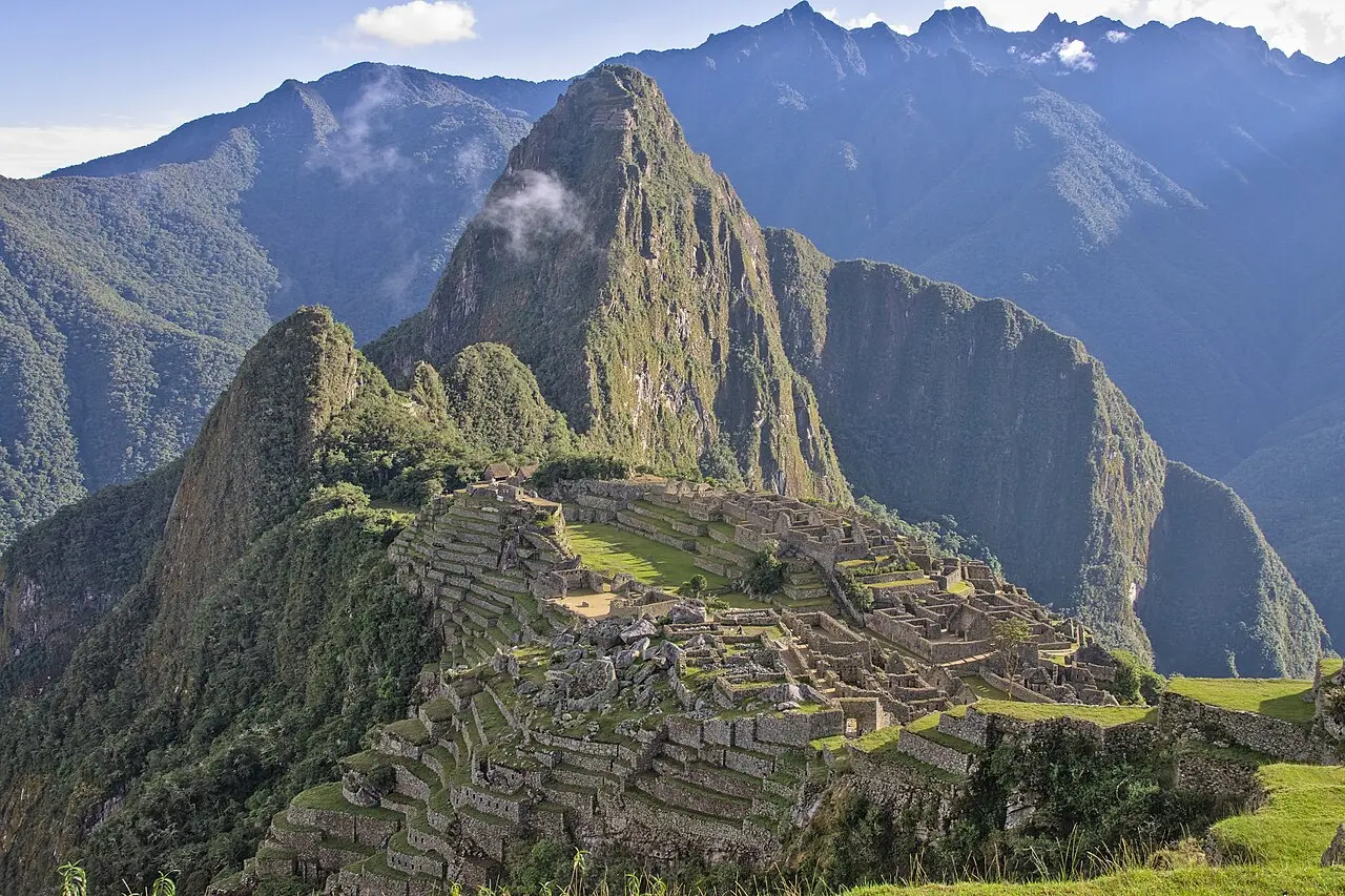
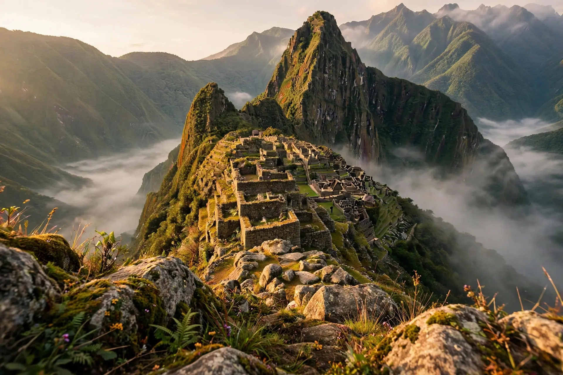
Using satellite imagery and field measurements, Menegat mapped a dense web of fractures and faults at scales from tiny cracks in individual stones to 175-kilometer lineaments that steer the region's river valleys. Several sets match the fault zones that uplifted the Central Andes over the past 8 million years. The NE-SW and NW-SE sets cross in an X right under the sanctuary, and the urban sectors, agricultural fields, individual buildings, and even stairs follow the fault trends. The abstract's conclusion is blunt: "We show that the Inca developers intentionally chose cross-tectonic faults to build their cities," and the city plan "clearly shows the empirical fault and fracture map which underlies its construction." The site itself sits at 7,970 feet (2,430 meters) on a narrow ridge about 50 miles (80 kilometers) northwest of Cusco, built around 1450 as a royal estate of the ruler Pachacuti Inca Yupanqui and abandoned roughly a century later during the Spanish conquest. See the full story of the sanctuary itself.
Why was cracked rock such an advantage?
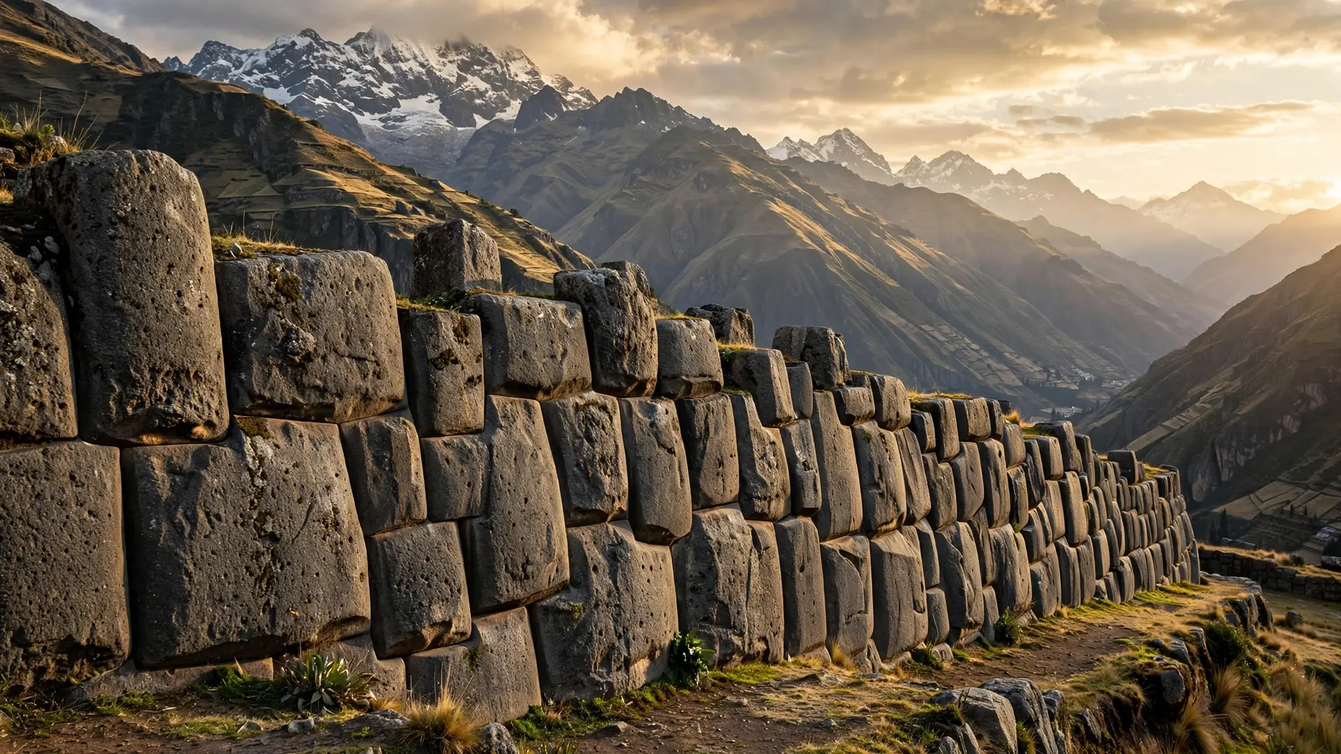
Where faults intersect, rock is broken into far more fragments than elsewhere, which meant an abundance of loose blocks at the surface and stone that split cleanly along existing planes. Carving building blocks from solid granite with stone tools is slow work; carving blocks that nature has already pre-split is far less. That advantage mattered doubly at altitude, where every kilogram of material had to be worked by hand, since the builders used no wheels and no iron tools. The Incas then fitted those blocks with legendary precision. Their mortar-free ashlar masonry joins stones so tightly that it is impossible to slide a credit card between them, a standard so exact that modern engineers still study it. The technique behind that fit deserves its own story.
How did faults solve the water problem?
Machu Picchu sits on a knife-edge ridge: too little water most of the year, and violent rainstorms that would destroy anything poorly drained. The fault web solved both. Fractures channeled meltwater and rainwater straight to the site from higher ground, while the same cracks carried storm runoff away during downpours. Reservoirs and canals across the city tapped that natural plumbing and fed irrigation water to the terraces.
Menegat estimates the hidden plumbing consumed an enormous share of the project: about two-thirds of the effort to build the sanctuary went into subsurface drainage. That investment is why the city survived five centuries of Andean weather in remarkable condition. Researchers believe the Incas may have located the fault intersections in the first place by following water seeps and drainages uphill from the valley, tracing the wet ground to the most fractured ground. The terraces made the same deal with water. More than 600 of them step down the slopes like staircases, growing maize and potatoes while layered topsoil, dirt, sand, and stone held moisture and stopped erosion and landslides on the steep ground. Reservoirs and canals throughout the city moved water through the natural plumbing to the terraces that needed it.
What do people get wrong about building on a fault?
The common reading is that the Incas gambled: a spectacular city on shaky ground. The geology says the opposite. Fault intersections were prospecting markers for everything a mountain city required: stone, water, drainage. And the architecture was tuned for shaking. Builders skipped mortar, which would have locked walls into rigid, crack-prone panels, and instead used thick backward-sloping walls, small trapezoidal windows and doorways, inclined walls, and rounded corners to spread earthquake forces. Ollantaytambo used the same thinking at fortress scale.
| Fault scale | Size | What the Incas got from it |
|---|---|---|
| Regional lineaments | Up to 175 km (109 mi) | The X-shaped fault intersection that marks the site |
| Site-scale sets | 020°, 055°, 330° + N-S/E-W | Orientation of sectors, buildings, stairs, and fields |
| Stone-scale fractures | Visible in individual blocks | Pre-split rock that broke along clean planes |
| "Machu Picchu clearly shows us that the Incan civilization was an empire of fractured rocks." Menegat's line works as geology and as tribute: a civilization that read the ground beneath it and built accordingly. | ||
| Whatever else drew the Incas to that ridge, the geology explains why the city could be built there at all. The X marks more than a spot on a map: it marks a supply depot, a waterworks, and a drainage system the builders read in the rock before laying a single stone. | ||
| How we made this article: FactSpire researched and drafted it with AI assistance and checked every fact against the sources listed above. |
Frequently asked questions
Was it dangerous to build Machu Picchu on a fault line?
The Incas treated the faults as an asset, not a hazard. The crossing fractures supplied ready-made building stone and natural plumbing, while the city's mortar-free masonry, sloping walls, and trapezoidal openings were designed to ride out earthquakes.
How did the Incas know the faults were there?
Researchers believe they followed water seeps and natural drainages uphill to where the faults intersected. Water moves through fractured rock, so the wettest ground marked the most fractured, most buildable sites.
Are other Inca cities built on fault lines too?
Yes. The same mapping found Ollantaytambo, Pisac, and Cusco sitting at fault intersections, each city's layout following its local fault directions. The pattern suggests a deliberate, repeated strategy.
Why didn't the Incas use mortar?
Mortar would have made rigid walls that crack in earthquakes. Their mortar-free ashlar masonry fit stones so tightly that a credit card cannot slide between them, and the blocks can shift and settle back during tremors.
Sources
- HOW INCAS USED GEOLOGICAL FAULTS TO BUILD THEIR SETTLEMENTS, Geological Society of America (2019 Annual Meeting abstract)
- Machu Picchu: Ancient Incan sanctuary intentionally built on faults, ScienceDaily
- Why Did the Inca Build Cities in Peru's Fault Zones?, Archaeology Magazine
- Finding Faults with the Inca, EarthDate