How Long Is the Mid-Ocean Ridge, Earth's Longest Range?
How long is the mid-ocean ridge? At nearly 65,000 km, it is Earth's longest mountain range, and over 90 percent of it lies hidden beneath the ocean.
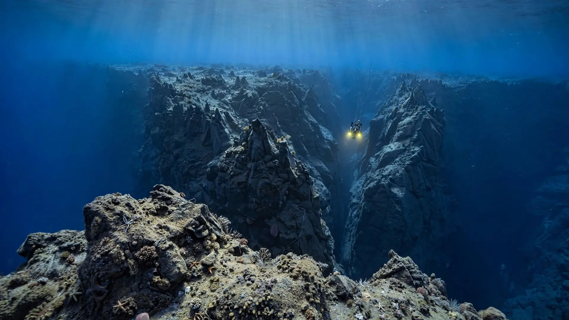
Key takeaways
- The mid-ocean ridge stretches nearly 65,000 km (40,390 miles), making it Earth's longest mountain range.
- More than 90 percent of the system lies underwater, with its crest about 2,500 m (8,200 ft) below the surface.
- Marie Tharp mapped its central rift valley in 1952, and her work helped prove seafloor spreading.
- The Mid-Atlantic Ridge alone runs more than 16,000 km (9,942 miles), over twice the length of the Andes.
- The ridge spreads 2 to 16 cm (0.8 to 6 in) a year, building new ocean floor as plates pull apart.
The mid-ocean ridge is about 65,000 km (40,390 miles) long, which makes it the longest mountain range on Earth. More than 90 percent of it lies underwater, hidden beneath the oceans. It winds through every major ocean basin, and its tallest peaks never break the surface except in a few places, such as Iceland.
- The system stretches nearly 65,000 km (40,390 miles), and more than 90 percent of it is underwater. NOAA Ocean Exploration
- The crest sits under about 2,500 m (8,200 ft) of water on average. NOAA Ocean Exploration
- NOAA calls the system the largest single volcanic feature on Earth, built from thousands of individual volcanoes. NOAA Ocean Service
- The Mid-Atlantic Ridge spreads 2 to 5 cm (0.8 to 2 in) a year, while the East Pacific Rise spreads 6 to 16 cm (2.4 to 6.3 in) a year. NOAA Ocean Exploration
- Marie Tharp spotted the ridge's central rift valley in 1952 while plotting sonar profiles at Columbia University's Lamont Geological Observatory. Columbia Climate School
What exactly is the mid-ocean ridge?
The mid-ocean ridge is a connected system of underwater volcanic mountains that forms where tectonic plates pull apart. At these divergent boundaries, molten rock rises from the mantle to fill the gap, cools in the cold seawater, and hardens into new basalt crust. Fresh ocean floor is always being built along the ridge while older crust moves away on both sides. It bends and branches through the Atlantic, Pacific, Indian, Arctic, and Southern Oceans, linking separate ridge sections into a single global chain. Two of its best-known parts are the Mid-Atlantic Ridge, which runs down the center of the Atlantic Ocean, and the East Pacific Rise, which runs through the eastern Pacific. NOAA describes the whole system as the largest single volcanic feature on Earth, made of thousands of individual volcanoes or volcanic ridge segments that erupt from time to time. The shape of a ridge depends on how fast the plates are moving apart. Where spreading is slow, the ridge has steep, rough slopes and a deep rift valley down its center. The Mid-Atlantic Ridge is a slow-spreading ridge, opening 2 to 5 cm (0.8 to 2 in) a year and carrying a rift valley about as deep and wide as the Grand Canyon. Where spreading is fast, the ridge is broader and smoother. The East Pacific Rise spreads 6 to 16 cm (2.4 to 6.3 in) a year, too fast for a deep rift valley to form, so it has a smooth volcanic summit with a narrow crack along its crest instead.
Life clusters along the ridge, too. Hot water rich in minerals escapes through cracks in the crust at hydrothermal vents, and whole communities of animals live around them where no sunlight reaches. The ridge is a factory that builds ocean floor, a home for deep-sea life, and the engine that keeps Earth's surface moving.
How did scientists map a mountain range they could not see?
The first hints came in the mid-1800s, when crews laying the first submarine telegraph cables across the Atlantic found a raised area in the middle of the ocean floor. For a century after that, the ridge stayed mostly a guess. Ships could measure depth only one point at a time, by lowering a line or bouncing sound off the bottom, and the ocean hid everything between those points. The picture changed in 1952, when geologist Marie Tharp sat down at Columbia University's Lamont Geological Observatory with six sonar profiles taken across the North Atlantic. Lining them up side by side, she noticed that every profile showed the same V-shaped notch at the center of the ridge. She read the notch as a rift valley, a place where the seafloor was pulling apart and new rock was welling up from below. Her colleague Bruce Heezen first dismissed the idea as "girl talk," since it pointed straight at continental drift, a theory most American geologists then treated as heresy. It took him half a year to accept her reading, and three more years before the findings were published as an abstract, without crediting Tharp. Proof arrived from an unlikely skeptic. Jacques Cousteau, who doubted the rift valley existed, sailed into the Atlantic with an underwater camera rig to disprove it. At the First International Oceanographic Congress in 1959, his photos showed the rift's dark cliffs and fresh pillows of lava, giving the world its first real look at the valley. Tharp kept mapping, and in 1977 she and Heezen published the first map of the entire world ocean floor. In 1997, the Library of Congress named her one of the four greatest cartographers of the 20th century. She had never set foot on a research ship until 1968, barred for her first 20 years at Lamont by the superstition that women brought bad luck at sea. Her maps were drawn by hand, from soundings alone, and they turned out to be remarkably accurate.
How does it compare with the Andes and the Himalayas?
Put the numbers side by side and the gap is hard to believe. The Andes, the longest range on land, run about 7,000 km (4,350 miles) along South America's western edge. The mid-ocean ridge is more than nine times that length. Even one section of it, the Mid-Atlantic Ridge, runs more than 16,000 km (9,942 miles) from the Arctic to near Antarctica, over twice the length of the Andes. The Himalayas, home to Mount Everest, stretch only about 2,400 km (1,500 miles), though they hold the highest peaks on the planet.
| Range | Length | Setting | Height or depth |
|---|---|---|---|
| Mid-ocean ridge system | Nearly 65,000 km (40,390 miles) | Ocean floor, all basins | Crest about 2,500 m (8,200 ft) below the surface |
| Mid-Atlantic Ridge | More than 16,000 km (9,942 miles) | Center of the Atlantic Ocean | Rises above sea level in Iceland |
| Andes | About 7,000 km (4,350 miles) | Western South America | Aconcagua, 6,961 m (22,838 ft) |
| Himalayas | About 2,400 km (1,500 miles) | Asia | Everest, 8,848.86 m (29,032 ft) |
| Length is where the ridge wins. Height is where it loses. Its crest sits roughly 2,500 m (8,200 ft) below the waves, while Everest rises 8,848.86 m (29,032 ft) above sea level. The ridge is a giant measured sideways, not upward. Published estimates for the Andes range from about 7,000 km (4,350 miles) to 8,900 km (5,530 miles), depending on where the range's ends are drawn, and even that longest figure reaches only about one-seventh of the ridge. The comparison also shows why the two kinds of range exist at all: the Andes and the Himalayas were built by plates colliding, while the mid-ocean ridge is built by plates pulling apart. |
What do most people get wrong about the mid-ocean ridge?
The most common mistake is naming the wrong range as the longest. Ask most people and they will say the Andes or the Himalayas. Both are famous, and both are visible from land. The ridge wins the length contest by an enormous margin, yet it stays out of the conversation because almost all of it is underwater. Out of sight, in this case, really does mean out of mind. A second mistake is picturing the ocean floor as flat. Before Tharp's maps, many scientists assumed the same thing. The seafloor turned out to hold mountains, valleys, and volcanoes, and the ridge is only the largest example. A third mistake is thinking of the ridge as a single mountain chain with one name. It is a connected system of segments with different names, speeds, and shapes. The slow-spreading Mid-Atlantic Ridge, with its deep rift valley, looks nothing like the fast-spreading East Pacific Rise, with its smooth summit. The shared process is the same, but the results vary with the spreading rate. A final mistake is assuming the ridge was found by satellites. Its first detailed maps came from ship sonar soundings plotted by hand, one profile at a time. Tharp's 1952 discovery happened at a drafting table, not on a research vessel, and it took years of argument before the wider scientific community accepted what her maps showed. The mid-ocean ridge is Earth's longest mountain range by a distance, and it is still being built today. Every year, the Atlantic widens by a few centimeters and new crust hardens along the ridge, even as old crust sinks away elsewhere. The largest mountain system on the planet is one almost nobody will ever see, mapped by a woman who was not allowed on the ships that collected her data. How we made this article: FactSpire researched and drafted it with AI assistance and checked every fact against the sources listed above.
Frequently asked questions
How long is the mid-ocean ridge?
Nearly 65,000 km (40,390 miles), according to NOAA. That makes it the longest mountain range on Earth, more than nine times the length of the Andes. Over 90 percent of it lies underwater, which is why most people have never heard of it despite its size.
Is the mid-ocean ridge longer than the Andes?
Yes, by a wide margin. The Andes run about 7,000 km (4,350 miles) along South America's western edge, while the mid-ocean ridge system stretches nearly 65,000 km (40,390 miles). Even the Mid-Atlantic Ridge alone, at more than 16,000 km (9,942 miles), is over twice as long as the Andes.
Can you see the mid-ocean ridge above water?
In almost no places. More than 90 percent of the system is underwater, with its crest about 2,500 m (8,200 ft) below the surface on average. Iceland is the best-known exception, where the central zone of the Mid-Atlantic Ridge rises above sea level and visitors can stand on the spreading boundary.
Who discovered the mid-ocean ridge?
No single person. Sailors found hints of it in the mid-1800s while laying submarine cables across the Atlantic. Marie Tharp mapped its central rift valley in 1952 from sonar soundings, and her work helped prove that the seafloor spreads apart. The full world ocean floor map followed in 1977.
Sources
- What is a mid-ocean ridge?, NOAA Ocean Exploration
- What is the longest mountain range on earth?, NOAA Ocean Service
- Mid-Atlantic Ridge, UNESCO World Heritage Centre
- 8 Surprising Facts About Marie Tharp, Mapmaker Extraordinaire, Columbia Climate School
- Seafloor Spreading, National Geographic Education