How Tall Is Mount Everest? Why the Number Keeps Changing
Everest stands 8,848.86 meters tall by the latest official survey. Here is how 170 years of measurement reached that figure, and why it keeps moving.
Key takeaways
- China and Nepal jointly announced Everest's official height as 8,848.86 m in December 2020. It is often rounded to 8,849 m (about 29,032 ft).
- The first figure, 29,002 ft, averaged sightings taken in 1849 and 1850 from six stations on the plains of India, about 175 km away. It was formally adopted in 1865.
- Early surveyors had to correct for light bending in the air, plumb lines pulled sideways by the mountains' mass, an unknown local sea level and seasonal snow.
- A Survey of India campaign in 1952 to 1954 produced 29,028 ft, or 8,848 m, a figure that stood for decades and still appears in references.
- GPS suggests Everest's rock rises about 2 mm a year. A 2024 study says rebound from river erosion adds 0.16 to 0.53 mm a year and some 15 to 50 m of its height.
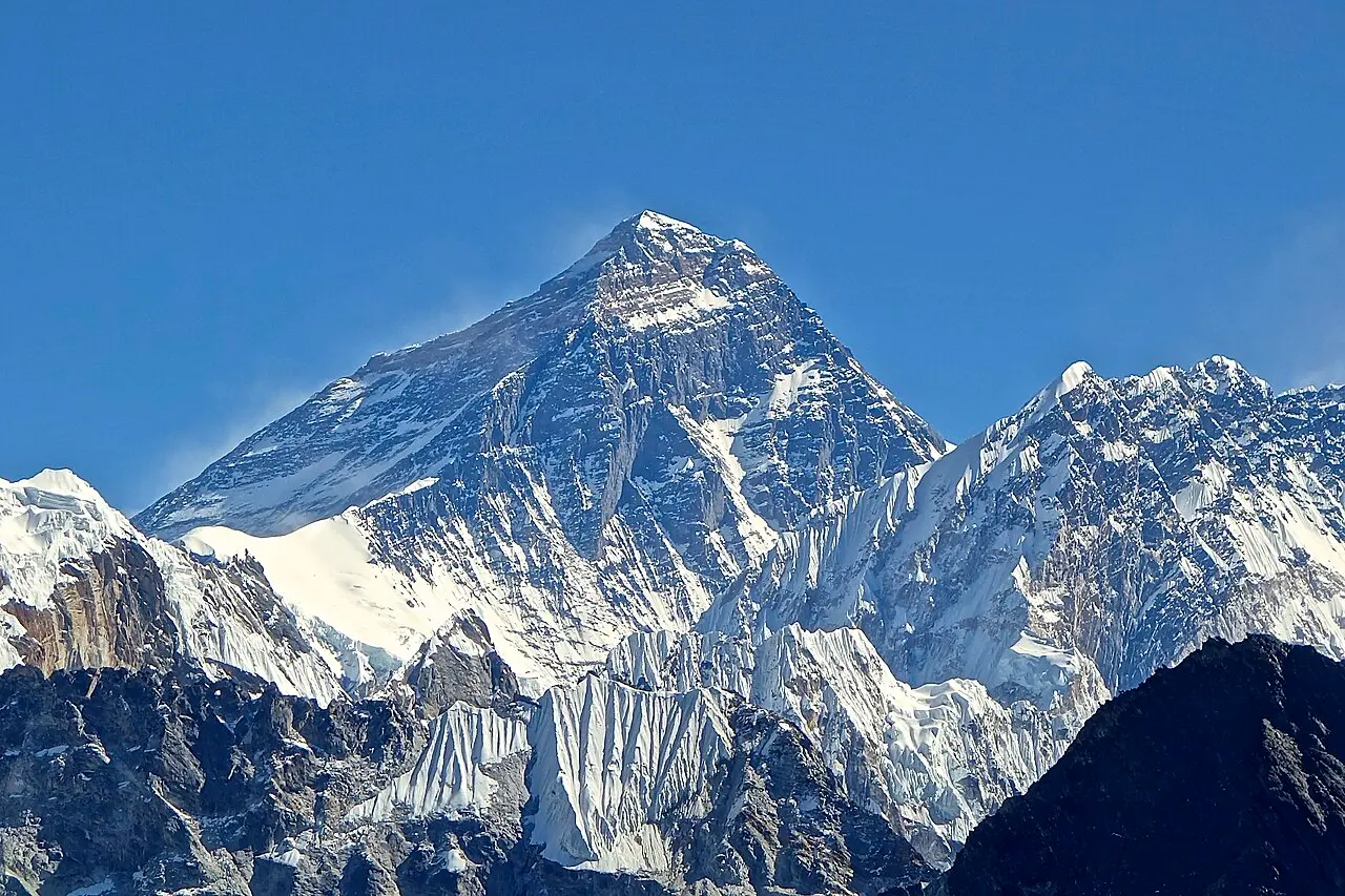
Mount Everest is 8,848.86 meters (about 29,032 ft) tall, according to the figure China and Nepal announced jointly in December 2020, and it is commonly rounded to 8,849 m. That number is the latest in roughly 170 years of answers, each a little different from the last. Measuring the top of the world turns out to depend on how light bends through the air, where sea level would sit beneath a mountain range, how much snow lies on the summit, and the inconvenient fact that the mountain is still rising.
How did surveyors first measure Everest?
From a long way off. In 1849 and 1850, observers with the Great Trigonometrical Survey of India took sightings of a distant summit, entered in their angle books simply as Peak XV, from six stations on the plains: Jarol, Mirzapur, Janjipati, Ladnia, Harpur and Minai. The mountain was roughly 175 kilometers (110 miles) away. Turning those angles into a height took years of arithmetic. Only in 1852 did the computations reveal that Peak XV outranked every other known mountain, and by 1856 the survey had made the discovery public. The figure that emerged, 29,002 feet (about 8,840 m), was the mean of the results from all six stations, and the survey judged it reliable enough to adopt formally only in 1865. A popular story credits the discovery to Radhanath Sikdar, the survey's Bengali chief computer, who is said to have burst into the Surveyor General's office announcing that he had found the highest mountain in the world. Writing in 1952, B. L. Gulatee of the Survey of India pointed out that earlier survey accounts contradict that story, and argued that whoever ran the numbers in a computing office should not be regarded as a peak's discoverer. The credit, in his view, belonged to the survey as a whole. The name came from the top of the organization. In the mid-1850s Andrew Waugh, then Surveyor General, proposed naming the peak after Sir George Everest, who had held the post of Surveyor General of India until retiring in 1843 and whose achievement was the geodetic framework of the survey rather than any work on this mountain. Tibetans already called it Chomolungma, often translated as "Mother Goddess of the World", and in Nepal it is Sagarmatha.
Why did the number keep changing?
Because the surveyors were fighting physics they could only partly correct. Light bends as it passes through layers of air of differing density, so a summit seen from some 175 kilometers away appears higher than it really is. For Everest the correction for this refraction ran to as much as 1,375 feet (about 420 m), and Gulatee suspected the survey's assumptions about it were off by enough to cause an error of some 200 feet. The mass of the Himalayas also tugs sideways on surveyors' plumb lines, skewing their sense of vertical, and no correction for that was applied to the original sightings. Even sea level is not level. The mountains' gravity may raise the geoid, the surface that sea level would follow beneath the land, by something like 150 feet (about 45 m), a quantity nobody could then measure. And the summit wears a cap of snow that thickens and thins with the seasons. So the answers drifted. Later estimates, in 1905 and 1922, gave 29,141 and 29,149 feet. Then, between 1952 and 1954, the Survey of India observed the peak again, timing the work for December to March, when summit snow was likely to be at its thinnest. The result was 29,028 feet, or 8,848 meters. Gulatee put the odds at 20 to 1 against it being wrong by more than 10 feet, while warning that monsoon snowfall could change the summit's height by well over 10 feet. The 8,848 m figure held for decades and still appears in references, including NOAA's.
How is Everest measured today?
With satellites as well as theodolites, although the old problems have not gone away. A satellite-navigation receiver on the summit can pin down its position very precisely, using the same atomic-clock timing that keeps GPS satellites accurate. What it measures directly, however, is height above a smooth mathematical model of Earth's shape, not height above sea level. Converting one into the other requires a model of the geoid built from gravity measurements, which is why modern surveys pair satellite fixes on the summit with gravity data and sightings from below. The work still has to be done in what mountaineers call the death zone, the region above about 8,000 meters, and surveyors still have to decide whether the top of the snow or the rock beneath it counts as the summit. Older figures linger, too. National Geographic's own pages give both 8,849 m and 8,850 m (29,035 ft), while NOAA keeps 8,848 m.
Is Everest still growing?
Yes, slowly. The mountain sits in the collision zone where India is still pushing into Asia, a story told in our explainer on how the Himalayas formed. GPS measurements suggest its rock is currently rising by about 2 millimeters a year, roughly twice the long-term rate recorded in the cooling history of its minerals. A 2024 study in Nature Geoscience offered one reason. Everest stands about 250 meters higher than the other tallest Himalayan peaks, an anomaly the authors linked to the Arun River, a tributary of the Kosi that drains a large area north of the mountain before turning south past it. Their models suggest the Arun captured a large upstream drainage area about 89,000 years ago and then carved a deep gorge. Stripping away so much rock lightened the crust, which rose in response, the way a boat rides higher as cargo is unloaded. The authors estimate that this rebound now adds 0.16 to 0.53 mm a year to Everest's uplift and accounts for roughly 15 to 50 meters of its height. Neighboring Makalu has been lifted too. None of this will change the summit sign soon. The rebound adds well under a millimeter a year, while seasonal snow on the summit may vary by meters. Everest's number keeps shifting mainly because the methods keep getting better.
Is Everest the tallest mountain on Earth?
It is the highest point above sea level, which is what most people mean. By other yardsticks it loses. Hawaii's Mauna Kea rises more than 10,210 meters from its base on the ocean floor, the greatest base-to-summit height of any mountain, as our piece on how volcanic islands form explains. And because Earth bulges at the equator, the summit of Ecuador's Chimborazo, only 6,268 meters above sea level, lies more than 2,072 meters farther out from the planet's center than Everest's peak does. Above sea level, though, Everest stands well clear of its nearest rival: K2, the second-highest peak, reaches 8,611 meters. Everest's height is less a fixed fact than a measurement with a history. The 29,002 feet of the 1850s came from sightings about 175 kilometers away, corrected with assumptions about air and gravity; the 1950s survey narrowed the uncertainty to a few meters; satellites and gravity models have narrowed it further. What remains is partly definition, whether to count the snow and where exactly to place sea level beneath the mountains, and partly geology, because the mountain keeps rising by millimeters a year.
Frequently asked questions
How tall is Mount Everest?
8,848.86 meters (about 29,032 feet), the figure China and Nepal announced jointly in December 2020. It is often rounded to 8,849 m, and older references give 8,848 m or 8,850 m.
Why does Everest's height keep changing?
Each measurement depends on how surveyors correct for light bending in the atmosphere, where sea level would lie beneath the mountains and how much snow is on the summit. Better methods keep refining the answer, and the mountain itself is slowly rising.
Who first measured Mount Everest?
The Great Trigonometrical Survey of India, which observed the peak, then known as Peak XV, from six stations on the plains in 1849 and 1850. Its chief computer, Radhanath Sikdar, is often credited, but the popular story of his discovery is disputed.
Is Mount Everest still growing?
Yes. GPS measurements suggest its rock is rising by about 2 millimeters a year, and a 2024 study found that erosion by a nearby river adds up to about half a millimeter a year through rebound of the crust.
Sources
- Mount Everest is more than two feet taller, China and Nepal announce, National Geographic
- MOUNT EVEREST-ITS NAME AND HEIGHT, The Himalayan Journal / Survey of India
- THE HEIGHT OF MOUNT EVEREST: A NEW DETERMINATION (1952-5), The Himalayan Club
- Recent uplift of Chomolungma enhanced by river drainage piracy, Nature Geoscience
- What is the highest point on Earth as measured from Earth's center?, NOAA National Ocean Service
- K2 | Peak, Geography, History, & Map, Encyclopaedia Britannica