
Why Do Clouds Have Flat Bottoms? The Science Explained
Why do clouds have flat bottoms? Every cloud in one sky forms at the same height, the lifting condensation level, where rising air cools to its dew point.
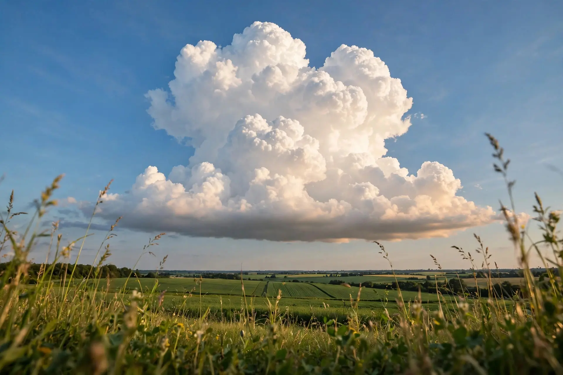
Key takeaways
- A cloud's flat base marks the lifting condensation level, the height where rising air cools to its dew point and water vapour first turns into droplets.
- Bases line up across one sky because the temperature and dew point near the ground are nearly the same everywhere in that area.
- Rising unsaturated air cools at 9.8°C per km (5.5°F per 1,000 feet), so each 1°C gap between temperature and dew point lifts the base by about 125 m (410 feet).
- Cumulus bases usually sit below 2,000 m (6,500 feet), while their tops can climb toward the tropopause, 12 to 17 km (7 to 11 miles) up.
- Up close the base is no sharp edge at all: flying through one shows a gradual fade from clear air into cloud.
Clouds have flat bottoms because every cloud in the same sky starts at the same height. Warm air rises, cools as it climbs, and at one specific altitude, the lifting condensation level, its temperature meets its dew point and water vapour turns into droplets. Below that line no cloud can form, so every base lines up.
Key facts
- The flat line is a height, not a surface. A cloud base sits at the lifting condensation level (LCL), where rising air first reaches 100% relative humidity and vapour condenses into droplets. University of Wisconsin–Madison
- Rising air cools at a fixed rate. Unsaturated air cools by 9.8°C for each kilometre it climbs (5.5°F per 1,000 feet), because expanding into lower pressure takes energy from the air itself. University of British Columbia
- Two numbers from a weather app give the base height. Each 1°C gap between the temperature and the dew point lifts the LCL by about 125 m (410 feet). University of British Columbia
- Cumulus bases stay low. Puffy cumulus clouds typically have flat bases below 2,000 m (6,500 feet), with heaped tops that can tower far above. Royal Meteorological Society
- The ceiling above is the tropopause. Rising air stops at the top of the troposphere, 12 to 17 km (7 to 11 miles) up, which is why tall storm clouds spread into flat anvil tops. Colorado State University, CMMAP
- The flatness checks out against instruments. In an Oklahoma field experiment, LCL heights calculated from surface temperature and dew point matched lidar-measured cloud bases very well, while trained weather observers at Oklahoma City airport often judged the same heights poorly by eye. University of British Columbia
What sets the height of a cloud's base?
Picture a bubble of air warmed by sun-heated ground. As it rises, the pressure around it falls, so the bubble expands. Expanding takes energy, and with no heat flowing in from outside, that energy comes from the air itself, which cools as it climbs. Meteorologists call this the dry adiabatic lapse rate: 9.8°C per kilometre (5.5°F per 1,000 feet).
Meanwhile the dew point, the temperature at which the air would be saturated, barely changes during the climb. The rising air cools toward its dew point, and the moment the two meet, the air hits 100% relative humidity. Water vapour condenses onto tiny dust and salt particles, and a cloud appears. That meeting point is the lifting condensation level, and nothing visible can form below it. The reason every base in a sky lines up is that the starting conditions are nearly the same everywhere in that area. On a summer afternoon the ground temperature and the dew point vary by only a degree or two across a whole county, so every rising thermal reaches saturation at almost exactly the same height. The flat bottom is, in effect, a visible reading of the day's temperature and humidity. When the lifting condensation level drops all the way to the ground, the same process makes fog on a still morning: the air at ankle height is already saturated, so the cloud forms where you stand. Rising air shapes more than clouds, too. The same physics that lifts a thermal helps decide why hurricanes spin in opposite directions on either side of the equator.
Why is the base flat while the top billows?
Below the base, every parcel follows the same cooling rule, so they all turn visible at the same height. Above the base, the rules change. Condensation releases latent heat inside the rising air, so the parcel now cools more slowly and stays warmer than its surroundings for longer. It keeps climbing, and each thermal rises by a different amount depending on how warm and moist it started. The result is a row of identical flat bases with tops that puff up to different heights, like loaves rising in the same oven at different speeds. The air above you is never still, which is also why stars twinkle while planets shine steadily. That restless air feeds new thermals into the cloud all day, so a cumulus top keeps rebuilding itself even as its base holds its line. The tops do have a limit. Rising air eventually reaches the tropopause, the boundary at the top of the troposphere, 12 to 17 km (7 to 11 miles) up depending on latitude and season. Air cannot easily push past it, so a tall storm cloud spreads sideways there into the flat anvil shape that marks a mature thunderstorm.
Can you work out a cloud's base height yourself?
Yes, with two numbers from any weather app: the temperature and the dew point. Subtract the dew point from the temperature, then multiply the gap by 125 m (410 feet) for each degree Celsius. The rule comes from the University of British Columbia's atmospheric science course, and it applies to puffy cumulus clouds rather than flat layers of stratus.
| Temperature | Dew point | Gap | Cloud base height |
|---|---|---|---|
| 24°C (75°F) | 22°C (72°F) | 2°C | 250 m (820 feet) |
| 20°C (68°F) | 14°C (57°F) | 6°C | 750 m (2,461 feet) |
| 30°C (86°F) | 20°C (68°F) | 10°C | 1,250 m (4,101 feet) |
| The pattern is easy to read. A small gap means humid air, so the base sits low, sometimes only a few hundred metres up. A wide gap means dry air, so the base climbs past a kilometre. On a hot, dry afternoon in Arizona the base can sit above 3,000 m (10,000 feet), while on a humid morning in Florida it may hang below 600 m (2,000 feet). | |||
| The same calculation is used by pilots, who need to know how much clear air sits below the clouds. The University of British Columbia compared LCL heights worked out from surface readings against lidar measurements in Oklahoma and found very good agreement, a reassuring result for a formula that fits on a sticky note. |
What most people get wrong about flat cloud bases
The first mistake is imagining a shelf. There is no physical surface under a cloud, no floor the droplets rest on. The base is simply the lowest height where the air is cool and damp enough for droplets to exist. Below that line the same air is still rising, just invisible, because its water is still vapour. The second mistake is trusting the sharp edge. From the ground a cumulus base looks sliced with a ruler, but a plane flying through one finds no sharp boundary at all. The droplets thin out gradually over tens of metres, and the crisp line is a trick of distance, the same way a forest looks like a solid wall from far away. The third mistake is assuming every cloud plays by this rule. Layered stratus clouds often have uneven, ragged bases. Storm clouds can grow pouch-like mammatus lobes that sag below the base. And a cloud's base height changes through the day: as the sun warms the ground and the dew point shifts, the whole line of bases can rise by hundreds of metres between morning and afternoon. Next time a summer sky fills with flat-bottomed cumulus, look at the line their bases share. It is a measurement made visible: one height, fixed by the temperature and the dew point of the air below, drawn across the sky in cloud. The tops can billow as high as they like, but the floor is set by the air itself. How we made this article: FactSpire researched and drafted it with AI assistance and checked every fact against the sources listed above.
Frequently asked questions
Why do all the clouds in one sky have bases at the same height?
Because the air near the ground has nearly the same temperature and dew point across the whole area, every rising parcel of air reaches saturation at nearly the same altitude. That shared height is the lifting condensation level, and it shows up as a flat line of cloud bases stretching across the sky.
How can I estimate a cloud's base height myself?
Take the temperature and the dew point from any weather app, subtract the dew point from the temperature, and multiply the gap by 125 m (410 feet) per degree Celsius. A 6°C gap gives a base near 750 m (2,461 feet). The rule works for puffy cumulus clouds, not for flat layers of stratus.
Why is the bottom of a cloud darker than the top?
The top of a cumulus cloud catches direct sunlight, while the base sits in the cloud's own shadow. Sunlight also has to pass through the full thickness of the cloud to reach the underside, so less light gets through and the base looks grey, even on a bright day.
Do clouds always have flat bottoms?
No. Puffy cumulus clouds are the classic flat-bottomed type, but many clouds break the pattern. Layered stratus clouds can have ragged bases, and storm clouds grow pouch-like mammatus lobes that hang below the base.
Sources
- Why are clouds relatively flat on the bottom?, The Weather Guys, University of Wisconsin–Madison
- UBC ATSC 113 – LCL Computation, University of British Columbia
- Cloud Spotting for Beginners Part 4: Cumulus, Royal Meteorological Society
- How do clouds form?, Colorado State University, CMMAP