What Is Freezing Rain, and Why Is It So Dangerous?
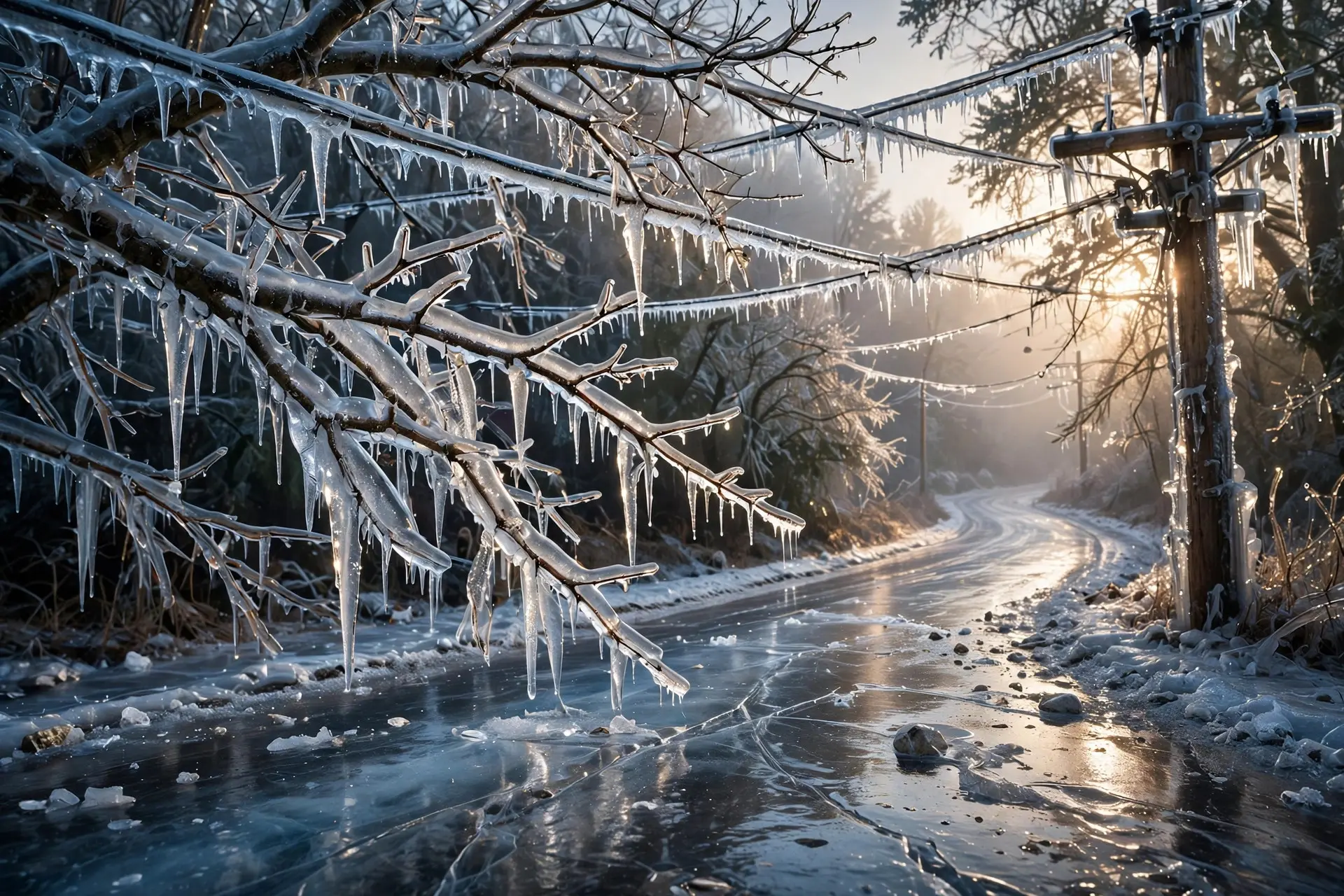
Freezing rain stays liquid below freezing, then turns to glaze ice on contact. It coats roads, trees and power lines, and a thin layer can be devastating.
Key takeaways
- Freezing rain begins as snow, melts in a warm layer aloft, then stays liquid below freezing until it strikes a cold surface and freezes on contact.
- Sleet differs because its drops freeze in the air before landing, while freezing rain freezes only on contact, forming a solid glaze.
- Even a quarter inch of ice can disrupt travel and power, and a half inch can bring widespread outages and falling trees.
- Bridges and overpasses ice first because cold air surrounds them on all sides, so they freeze faster than ordinary roads.
It does not look like a disaster. Freezing rain falls as ordinary drizzle, quiet and unremarkable, and then the world turns to glass. Roads become skating rinks, branches sag under a clear, heavy coat, and power lines droop lower by the hour. Meteorologists call it one of winter's most dangerous hazards, and the reason is simple: freezing rain is liquid water that refuses to freeze until the exact moment it touches something, and then it freezes everywhere at once.
How does freezing rain form?
Freezing rain begins high in the sky as snow. As the flakes fall, they pass through a layer of warm air well above the ground, a slice of the atmosphere sitting above freezing, and they melt completely into raindrops. Below that warm layer, near the surface, sits a shallow layer of freezing air hugging the ground. This is where the story takes its strange turn. The drops falling into that cold layer do not freeze in midair. To freeze, water needs something to freeze onto, and these drops have lost their ice crystals when they melted. So they become supercooled: liquid water cooled below freezing point yet still liquid, waiting for a surface. If the freezing layer near the ground is thin, the drops run out of time before they can freeze on their own, and they reach the ground still liquid. The instant they strike a cold road, branch, wire or windshield, they finally have a surface to freeze on, and they do so immediately, spreading into a smooth, clear coat of glaze ice. The setup usually appears where warm and cold air masses meet, most often on the northern side of a warm front, where mild air rides up over a shallow pool of cold air trapped at the surface. That layering is delicate. Nudge the temperatures a degree or two in either direction, and the same storm delivers snow or plain rain instead, which is part of why freezing rain is so difficult to predict.
How is freezing rain different from sleet and snow?
Freezing rain and sleet are siblings, and the difference between them comes down to the thickness of the cold layer near the ground. In both cases, snow melts in a warm layer aloft and falls into freezing air. With sleet, the freezing layer is thick enough that the drops finish freezing before they land, arriving as small, bouncing ice pellets. With freezing rain, the freezing layer is so thin that the drops stay liquid until impact, and they freeze only on contact.
Snow is simpler still: it never meets a warm layer deep enough to melt it, so it reaches the ground as flakes. That difference matters for what happens next. Snow piles up and can be plowed. Sleet pellets bounce, accumulate loosely and can be swept or shoveled. Freezing rain does neither: it bonds to whatever it lands on as a solid sheet, growing thicker layer by layer as more rain falls, in a process forecasters call accretion rather than accumulation. You cannot shovel glaze ice off a power line or a tree branch, and scraping it off a road takes far more than a plow.
Why is freezing rain so dangerous on roads?
Because it removes traction without warning. A thin glaze can coat pavement so smoothly that drivers lose control with little notice, and the danger is worst exactly where drivers least expect it: bridges, overpasses and other elevated roadways. Those structures are surrounded by cold air on all sides, so they freeze faster than roads sitting on the warmer ground. A driver can cross dry-looking pavement onto a bridge that is already a sheet of ice. The toll is grim. The U.S. National Weather Service has described freezing rain as the worst of winter driving hazards, more dangerous than snow because ice can form directly on pavement. In February 2021, an ice storm in Fort Worth, Texas, led to a pileup of 135 vehicles on Interstate 35W that killed six people. Federal highway figures count more than 1,300 people killed on snowy or icy pavement each year. Freezing rain is also a hazard on foot: sidewalks, steps and railings ice over just as roads do, and a small amount of icing can create serious slip-and-fall danger before anyone realizes how slick the surface has become.
Why does it bring down trees and power lines?
Because ice is heavy, and freezing rain puts that weight everywhere at once. Unlike snow, which can slide off a steep roof or be shaken from a branch, glaze ice grips every surface and keeps growing. A quarter inch of ice can already disrupt a region, with slick roads, scattered power outages and some tree damage. At a half inch, the effects turn crippling: widespread outages and falling trees and lines as branches and wires surrender to the load. In the largest storms, ice more than an inch thick can tear down most of a region's power grid, leaving outages that last days.
December 2007 gave the American Midwest a stark example. An ice storm left wide areas of Kansas under one to two inches of ice, with some spots seeing two to four inches, and many areas went without power for one to two weeks. Damage to electrical infrastructure alone was estimated at 136.2 million dollars, making it the costliest ice storm in Kansas history. The pattern repeats wherever freezing rain strikes hard: limbs snap under the weight, lines sag and break, and fallen trees block roads, trapping residents and slowing repairs. Major ice storms are rare in any one place, striking roughly zero to two times in 25 years by one forecast office's reckoning, but that rarity makes them more dangerous, not less, because communities may have no living memory of the last one.
Why is freezing rain so hard to forecast?
Because the whole phenomenon balances on a knife edge of temperature. Ice storms are notoriously hard to forecast, since small changes in temperature through the first few thousand feet of the atmosphere can make big changes in the impact at the ground. A warm layer slightly too shallow leaves snow; a cold surface layer slightly too deep turns the storm to sleet; a surface temperature a degree above freezing turns the whole event into a cold rain that nobody remembers. Forecasters watch the layering closely, and they issue ice storm warnings and freezing rain advisories with long lead times precisely because the margin for error is so small and the consequences of getting it wrong are so large. That forecasting difficulty is also why freezing rain deserves more respect than its gentle appearance suggests. It is not a blizzard. There is no dramatic snowfall to photograph, no howling wind to hear. There is only a quiet drizzle and a world slowly turning to glass. If a forecast calls for freezing rain, the safest move is to stay off the roads, keep clear of trees and power lines, and treat every outdoor surface as if it were already ice. Like ball lightning, another rare phenomenon that defies everyday intuition, freezing rain reminds us that the atmosphere does not always behave the way common sense expects. The difference is that freezing rain arrives every winter somewhere, and when it does, it is the quietest storm that can bring a region to a standstill. Winter storms hold other surprises too, from thundersnow to sudden ice, but few combine invisibility, weight and reach the way freezing rain does.
Frequently asked questions
What is the difference between freezing rain and sleet?
Both start the same way, but sleet falls through a thicker layer of freezing air and freezes into ice pellets before reaching the ground. Freezing rain falls through a thin freezing layer, stays liquid, and freezes the instant it touches a cold surface.
Why is freezing rain more dangerous than snow?
Snow can be plowed and driven on with care, but freezing rain coats every surface in smooth glaze ice that removes traction, adds crushing weight to trees and power lines, and cannot be shoveled away.
How much ice does it take to cause serious damage?
Surprisingly little. A quarter inch can cause slick roads, scattered outages and tree damage, while a half inch is often crippling, with widespread power outages and many trees and lines brought down.
Sources
- Freezing Rain and Sleet, National Weather Service Blacksburg
- What is freezing rain?, FOX Weather
- Identify Weather Threats Ice, National Weather Service Baltimore/Washington