What Is the Flattest Place on Earth? Salar de Uyuni
Salar de Uyuni in Bolivia varies less than one meter across 10,582 square kilometers: the flattest place on Earth, and a calibration target for satellites.
Key takeaways
- Salar de Uyuni, Bolivia, varies less than 1 meter in elevation across 10,582 square kilometers: the flattest measured surface on land.
- A September 2002 GPS survey found under 80 cm of relief over 2,000 km², accurate to 2.2 cm, to ground-truth NASA's ICESat altimeter.
- ESA calibrates the radar altimeters on its CryoSat and Copernicus Sentinel-3 satellites against the salar.
- Seasonal floods dissolve and redeposit salt, resurfacing the flat every rainy season.
- Abyssal plains like the Sohm Plain are flatter at vast scale; no land rival has a published precision measurement.
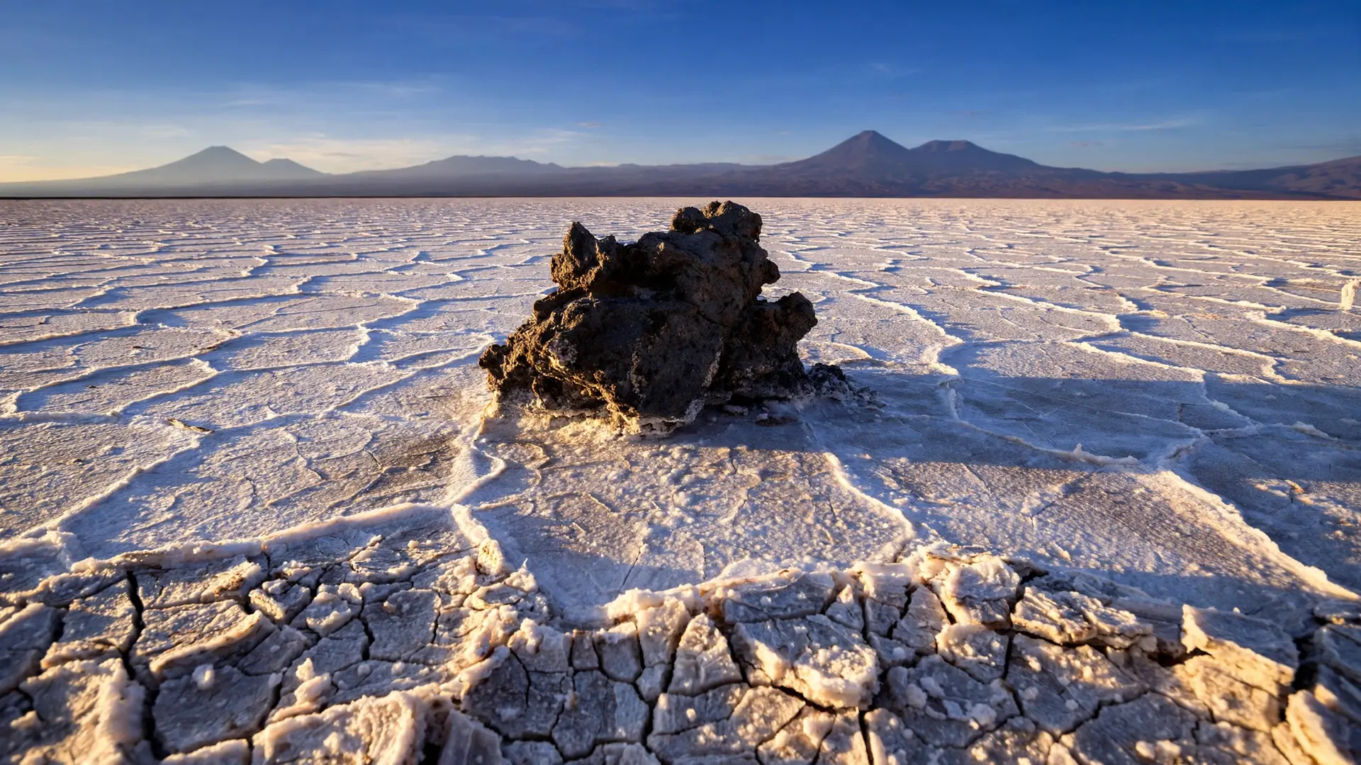
Salar de Uyuni, Bolivia, is the flattest place on Earth: its salt crust varies by less than one meter (3 ft 3 in) across 10,582 square kilometers (4,086 square miles), and the European Space Agency uses it to calibrate satellite altimeters. The real surprise is that the flat stays flat because each rainy season floods and resurfaces it.
- Salar de Uyuni covers 10,582 square kilometers (4,086 square miles) of southwestern Bolivia, the largest salt flat on Earth. (NASA Earth Observatory)
- The European Space Agency reports the surface varies less than one meter (3 ft 3 in) in elevation across the whole expanse. (ESA)
- A September 2002 kinematic-GPS survey measured under 80 centimeters (2.6 feet) of relief over 2,000 square kilometers (772 square miles), building a digital elevation model accurate to 2.2 centimeters (0.9 inches). (UC San Diego eScholarship)
- ESA calibrates the radar altimeters on its CryoSat and Copernicus Sentinel-3 satellites against the salar. (ESA)
- The crust formed when Pleistocene lakes including Lago Minchin dried out about 15,000 years ago, leaving salt more than 10 meters (33 feet) thick in places. (NASA Earth Observatory)
How flat is Salar de Uyuni, exactly?
Picture walking ten kilometers across a surface and ending up less than one meter higher or lower than where you started. That is what ESA means when it reports the salar's surface elevation variation at under one meter across the entire expanse. For comparison, the height difference between your kitchen floor and your countertop is roughly 90 centimeters. Uyuni holds that tolerance over an area about the size of Hawaii's Big Island. The figure is not a guess. In September 2002, a team of researchers drove a kinematic-GPS survey across the salar to ground-truth NASA's ICESat laser altimeter, then an upcoming mission to map ice-sheet elevation from orbit. Across the 9,000-square-kilometer heart of the flat, they found under a meter of total vertical relief. Over the 2,000-square-kilometer area they surveyed most densely, the relief was under 80 centimeters, half of that accounted for by a gentle planar tilt of the surface itself. The resulting digital elevation model had an absolute accuracy of 2.2 centimeters, about the width of a thumbnail. When engineers needed to know how precisely a laser in orbit could measure a surface, this was the ruler they built first.
How did it get so flat?
Uyuni sits in a closed basin on the Altiplano, a high plateau in the Andes with no drainage outlet to the sea. During the Pleistocene, enormous lakes filled this basin, the best known being Lago Minchin. About 15,000 years ago the climate dried and the lakes vanished, leaving a crust of halite, ordinary table salt, more than 10 meters thick in many places, sealing the basin floor. That crust is the raw material of the flatness, but not the reason it lasts. The reason it lasts is rain. Each rainy season, floods lay a thin sheet of water across the crust. The water dissolves salt from the slightly higher patches, carries it in solution to the slightly lower ones, and deposits it again as evaporation takes over. The salar resurfaces itself every year, smoothing out its own bumps. When the floods are deep enough and the wind drops, the same process sets up the thin, dead-calm water film behind Salar de Uyuni's famous mirror effect. The mirror and the flatness are two consequences of one mechanism. Like the Dead Sea, Uyuni is a basin where water arrives and only evaporation leaves; here, that one-way traffic writes its signature in salt.
Why do satellites need a surface this flat?
A satellite altimeter measures the distance from orbit to the ground with a pulse of light or radar, and from millions of those distances scientists build maps of Earth's topography. But a measurement is only as good as its calibration: engineers need a patch of Earth whose true shape they already know, so they can check what the instrument reports against it. That patch has to be large, stable, and bright to the instrument's signal. NASA's Earth Observatory notes that scientists working with both ICESat and the Envisat radar satellite used Salar de Uyuni to calibrate their sensors, because salt flats are "large, stable surfaces with strong reflection, much like ice sheets," and the Bolivian Altiplano adds clear skies. The practice continues. ESA confirms that Uyuni's extraordinary flatness makes it ideal for calibrating radar altimeters, the instruments that measure surface topography from orbit, and names the missions that rely on it: ESA's CryoSat and the Copernicus Sentinel-3 satellites. When a Sentinel-3 altimeter reports the height of a wave in the North Atlantic, part of the confidence in that number traces back to a salt flat in Bolivia. West of the salar, across the Chilean border, lies the Atacama, the driest place on Earth.
Could anywhere else claim the title?
Honestly: no official body confers a "flattest place" title, and no source I found compares measured relief across the rival candidates. What exists is a scientific convention backed by a measurement, and a set of contenders backed by adjectives.
The Bonneville Salt Flats in Utah are the obvious American rival. Utah's tourism office describes a crust of salt stretching over 30,000 acres (about 121 square kilometers) and calls the fields perfectly flat, the reason land-speed records run there. But "perfectly flat" in a tourism brochure is not a number, and no precision survey of Bonneville's relief has been published. Australia's Nullarbor Plain gets cited for the same reason NASA does: it is so level that the Trans-Australian Railway runs through it in a straight line for more than 483 kilometers (300 miles). Again, no measured relief figure. Then there is the deep ocean. The abyssal plains of the seafloor, at depths of 3,000 to 6,000 meters, cover more than half of Earth's surface, and plains like the Sohm Plain in the North Atlantic span roughly 900,000 square kilometers at gradients under one meter per kilometer of horizontal distance. By large-scale uniformity they are flatter than any land surface. The honest comparison is this: Uyuni is the flattest measured terrain on dry land; the abyssal plains are flatter at a scale no human will ever walk.
| Candidate | Size | Measured flatness | Verdict |
|---|---|---|---|
| Salar de Uyuni, Bolivia | 10,582 km² (4,086 sq mi) | Under 1 m relief (ESA); under 80 cm over 2,000 km² (GPS survey, 2002) | The only candidate with a published precision measurement |
| Bonneville Salt Flats, Utah | ~121 km² (30,000 acres) | No published figure | Described as "perfectly flat" (Utah.com); land-speed records |
| Nullarbor Plain, Australia | Spans southern Australia | No published figure | Railway runs straight for 483 km (NASA); no measured relief |
| Sohm Plain (abyssal), N. Atlantic | ~900,000 km² | Under 1 m per km slope | Flatter at vast scale, but underwater, not walkable land |
What most people get wrong about the flattest place
The first mistake is taking "flattest" to mean geometrically flat, like a tabletop. No surface this size is. The measurements are relative to the planet's curve, which is the only sensible way to define flatness at planetary scale, and even Uyuni's crust is textured with polygonal ridges at foot scale. Flatness here means elevation, not texture: the bumps are tiny and spread over enormous distances. The second mistake is assuming someone officially awarded the title. There is no record-keeper for flatness. Scientists call Uyuni the flattest place because the peer-reviewed measurement exists, and nobody has published a better number for anywhere else. It is a claim grounded in data, not ceremony. The third mistake is believing every salt flat is equally flat. Salt crusts all look level to the eye, but eyes are poor instruments. Calling a flat "the flattest" without a published measurement is marketing. Uyuni's distinction is not that it is a salt flat; it is that surveyors measured it to centimeter precision and wrote the numbers down. Uyuni holds the title for now: a 15,000-year-old lake bed that resurfaces itself every rainy season, measured to the centimeter, and trusted by the satellites overhead. The flattest place on Earth turns out to be not just a record but a tool, one the planet's orbiters cannot do without. How we made this article: FactSpire researched and drafted it with AI assistance and checked every fact against the sources listed above.
Frequently asked questions
How flat is Salar de Uyuni exactly?
ESA reports the surface varies by less than one meter across the whole 10,582-square-kilometer expanse. A September 2002 kinematic-GPS survey measured under 80 centimeters of relief over 2,000 square kilometers, with a digital elevation model accurate to 2.2 centimeters. That precision is why satellites use it as a reference.
Why do scientists calibrate satellites on Salar de Uyuni?
Satellite altimeters measure Earth's topography, and engineers need a known surface to check them against. The salar is enormous, stable, strongly reflective like an ice sheet, and sits under clear skies. NASA used it to ground-truth ICESat, and ESA calibrates CryoSat and Copernicus Sentinel-3 radar altimeters on it.
Is Salar de Uyuni flatter than the Bonneville Salt Flats?
Probably, but no published measurement says so. Utah's tourism office calls Bonneville's 30,000 acres perfectly flat, and land-speed records run there, yet no precision survey of its relief exists. Uyuni is the only candidate with a published sub-meter measurement, which is what the claim rests on.
Are the deep ocean's abyssal plains flatter?
At vast scale, yes. Plains like the Sohm Plain in the North Atlantic span about 900,000 square kilometers with slopes under one meter per kilometer. They win on large-scale uniformity, but Uyuni remains the flattest measured terrain on dry land, where people and satellites can actually use it.
Sources
- Uyuni salt flat, Bolivia, ESA
- An Expanse of White in Bolivia, NASA Earth Observatory
- Topography of the salar de Uyuni, Bolivia from kinematic GPS, UC San Diego eScholarship
- Image: Proba-V images Salar de Uyuni, Phys.org
- What Is the Flattest Place on Earth?, Biology Insights
- Bonneville Salt Flats, Utah.com