Where on Earth Do Four Countries Meet at a Single Point?
Kazungula on the Zambezi is the closest place on Earth where four countries meet at a single point, but legally it is two tripoints. Here is the honest story.
Key takeaways
- Kazungula, where Zambia, Zimbabwe, Botswana and Namibia converge on the Zambezi River, is the closest thing on Earth to a four-country point.
- It is not a true quadripoint: Zambia and Botswana share a border of about 135 meters (443 feet), splitting the meeting into two tripoints.
- That 135-meter line is the shortest international border in the world: too short to draw on small-scale maps, which is why maps show one dot.
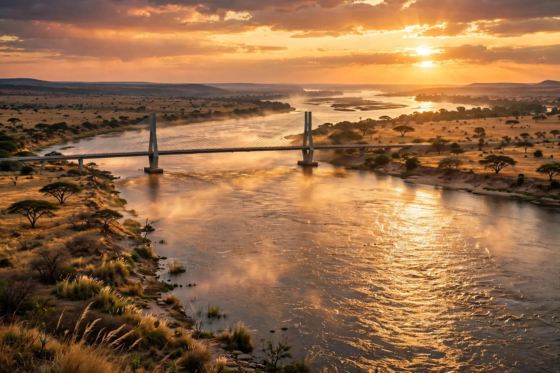
- The 923-meter (3,028-foot) Kazungula Bridge, commissioned on May 10, 2021, spans the border and replaced the old pontoon ferry.
Nowhere. Not legally. The famous "four corners of Africa" at Kazungula, where Zambia, Zimbabwe, Botswana and Namibia converge on the Zambezi River, is really two three-country points about 135 meters (443 feet) apart. The surprise: those 135 meters are a real border, the shortest international border in the world, and a $259.3 million bridge now crosses it.
- At Kazungula, on the Zambezi River, the borders of Zambia, Zimbabwe, Botswana and Namibia gather at the meeting of the Zambezi and Chobe rivers, the closest thing on Earth to a four-country point. (The “Quadripoint” Area, Sovereign Limits)
- It is not a true quadripoint: Zambia and Botswana share a border of about 135 meters (443 feet), which splits the convergence into two separate tripoints. (The “Quadripoint” Area, Sovereign Limits)
- That 135-meter line is the shortest international border in the world: so short it cannot be shown on small-scale maps, which is why maps draw a single point instead. (The “Quadripoint” Area, Sovereign Limits)
- The Kazungula Bridge, a 923-meter (3,028-foot) road-and-rail bridge with one-stop border posts on both banks, was commissioned on May 10, 2021, replacing the old pontoon ferry. (Kazungula Bridge Project, The Maravi Post)
- The $259.3 million project was co-financed by Botswana and Zambia with a $76.5 million African Development Fund loan to Zambia plus Japanese and EU-Africa funding; it was approved in December 2011 and completed in December 2020. (Kazungula Bridge Project, The Maravi Post)
- Five international boundaries meet in this small patch of river: Botswana–Namibia, Botswana–Zambia, Botswana–Zimbabwe, Namibia–Zambia and Zambia–Zimbabwe. (The “Quadripoint” Area, Sovereign Limits)
What Does Kazungula Look Like on the Ground?
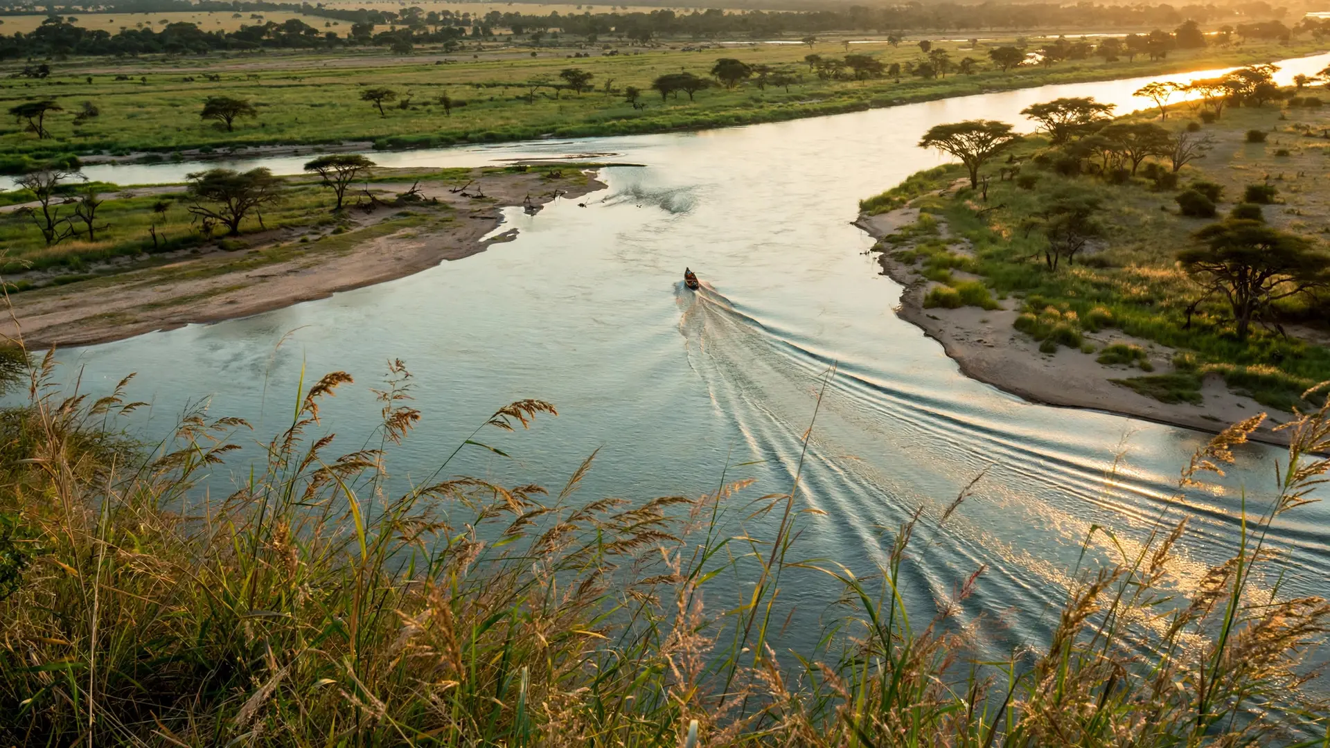
Picture the Zambezi River sliding past sandy banks under wide African skies, and the smaller Chobe River joining it from the west. Near that confluence sits Kazungula, and around it four countries press close: Zambia to the north, Zimbabwe to the east, Botswana to the south, and Namibia's long Caprivi Strip reaching east like a finger to almost touch Zimbabwe. Locals call the area the "four corners of Africa." But there is no signpost marking an exact spot, because there is no exact spot. Surveyors describe the geometry as a pair of tripoints (points where three borders meet) that almost, but do not quite, touch. Estimates of the gap vary depending on how it is measured: one account puts the underwater strip separating Namibia from Zimbabwe at about 75 meters, while boundary specialists Sovereign Limits measure the actual Botswana–Zambia border line at 135 meters (443 feet). Either way, the honest answer is the same: two tripoints joined by a very short line, not one point shared by four countries.
Why Isn't It a True Quadripoint?
Because a few dozen meters of river got in the way of the mapmakers. The tangle is a legacy of 19th-century colonial map-drawing in southern Africa, which left Namibia's Caprivi Strip stretched hundreds of kilometers eastward, nearly, but not quite, meeting Zimbabwe at the river. The borders were drawn to rivers and straight lines on colonial charts, and when four such lines converged on one confluence, they missed a perfect meeting by a margin you could walk in two minutes. The near-miss has caused real friction. In the 1970s, the ferry carrying people and goods across the river to Botswana became a subject of contention between the countries, a small cross-border squabble over who controlled the crossing. The argument underneath it was about whether Botswana and Zambia even shared a border at all: the question that decides whether the crossing sits on two countries' territory or four.
How Did a Bridge Settle the Argument?
A bridge needs solid legal ground to stand on, and the Kazungula Bridge supplied the answer by being built. Construction began in 2014 on a 923-meter (3,028-foot) extra-dosed cable-stayed bridge designed for both road and a future railway, with full one-stop border posts on each bank so travelers clear exit and entry in a single stop. On May 10, 2021, the presidents of Botswana and Zambia commissioned it together, and the pontoon boats that used to haul trucks across the Zambezi were retired.
The money tells the same story as the engineering. The $259.3 million project was funded 50-50 by the governments of Botswana and Zambia, backed by a $76.5 million African Development Fund loan to Zambia and co-financing from Japan's international cooperation agency and the EU-Africa Infrastructure Trust Fund. The bridge is jointly owned by the two governments and paid for through tolls: a two-country asset, not a four-country one. That two-country logic is the whole legal point. Before the bridge, most Botswana–Zambia trade was routed through Zimbabwe and taxed there, so a direct crossing was, in Sovereign Limits' words, "a matter of contention for Zimbabwe." But because the boundary is not a true quadripoint, Zimbabwe had no legal power to stop two nations from building a bridge over their own shared border. The 135-meter line that spoiled the perfect four-country point turned out to be exactly long enough to carry a bridge and to prove, in concrete and steel, that the border is real.
What Do Most People Get Wrong About the Four-Country Point?
| What people believe | What is actually true |
|---|---|
| You can stand in four countries at once at Kazungula. | There is no single meeting point: only two tripoints about 135 meters (443 feet) apart. |
| Maps prove four borders meet at one dot. | The Botswana–Zambia border is real but too short to draw at small scales, so cartographers collapse it to a point. |
| Building the bridge needed all four countries' permission. | Because it is not a true quadripoint, Zambia and Botswana could build over their shared border without Zimbabwe's approval. |
| The old ferry crossing was always a peaceful arrangement. | Control of the Kazungula ferry sparked a cross-border squabble between the countries in the 1970s. |
| The 135-meter line is the world's shortest international border, and boundary puzzles like this one come in many shapes, from the interlocking enclaves of Baarle, where Belgium and the Netherlands weave through a single town, to the tripoints that dot the world's mountain ranges. | |
| Kazungula is a reminder that borders are drawn by people, argued over by governments and finally fixed by engineers. Four countries came as close as geography allows to sharing a single point, and the 135 meters that stopped them became the shortest border in the world, and the foundation of a bridge. | |
| How we made this article: FactSpire researched and drafted it with AI assistance and checked every fact against the sources listed above. |
Frequently asked questions
Can you stand in four countries at once at Kazungula?
No. There is no single surveyed point where all four borders meet; legally, the area holds two tripoints about 135 meters (443 feet) apart, joined by the short Botswana–Zambia border. Drifting on a boat near the confluence of the Zambezi and Chobe rivers, you can pass through four countries' waters in minutes, but you cannot plant your feet in all four at once.
Why do maps show a single point where four countries meet?
Because the Botswana–Zambia border is only about 135 meters (443 feet) long, it is too short to depict at small map scales. Cartographers collapse it to a dot, which makes it look like one point where four countries meet. Boundary specialists call the area a 'quadripoint area': the closest thing on Earth to a true four-country point, while stressing the border itself is real.
What is the Kazungula Bridge?
It is a 923-meter (3,028-foot) extra-dosed cable-stayed bridge carrying road and rail across the Zambezi between Zambia and Botswana, with a one-stop border post on each side. Commissioned on May 10, 2021, the $259.3 million project replaced the pontoon ferry that used to carry travelers and trucks across, and it is jointly owned by the two governments.
Why did the bridge cause a dispute with Zimbabwe?
Before the bridge, most Botswana–Zambia trade moved through Zimbabwe and was taxed there, so a direct crossing cost Zimbabwe revenue, a real point of contention. But because Kazungula is not a true quadripoint, Zimbabwe had no legal power to stop Zambia and Botswana from building a bridge over their own shared border.
Sources
- The “Quadripoint” Area, Sovereign Limits
- Kazungula Bridge Project to expand regional integration and trade across southern Africa, The Maravi Post
- DailyNews, Botswana Government (DailyNews)
- Corners, Convergence and a Crossborder Conundrum, Rhino Africa